This page is the starting point for your exploration of Pine Valley/Valleywood through photographs. The historical photographs range from the construction of Pine Valley homes in 1958 through Valleywood circa 1966. In some cases, contemporary views are shown of the same scene in order to see the changes of the last 30 to 40 years. New photos or newly discovered old photos can be seen just below. For archives, scroll down and click on the PVVW Photos button.
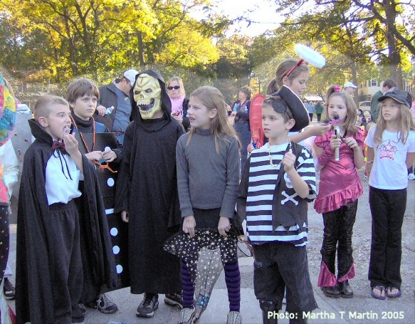
Halloween Parade 2005
 |
|
 |
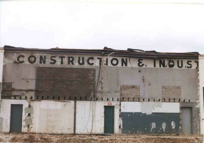 |
| Old businesses: Timonium Fairlanes (survives as AMF), Murphy's Mart, Lums, Fotomat, and Gino's (Courtesy Ellsworth Hall) | Old SM Christhilf Building lettering visible prior to demolition |
Unlike a printed document, this website can continue to grow and
evolve. While I have obtained some excellent photos from the generous
residents of PVVW, I can't help but feel that there are many more out
there. Please contact me if you have any photos from this era that you
would like to see added to the site. Future additions will include
still
photographs from 8mm movie film shot during the early years of the
neighborhood (one such image appears at top of page).
Clicking on the small image on the photo index page will take you to a larger image. While all of the larger images are under 150k, they may take a minute or two to load on slower connections. They may also exceed your screen size. If you would like to obtain higher resolution versions of these photos on disk, contact me.
There are a number of things that are intriguing about these photos. Particularly valuable are the aerial photos from 1960 and 1970. In 1960, construction had not yet begun on Valleywood. The thick woodland surrounding Pine Valley is undisturbed; the homes at the ends of the streets are virtually enveloped in trees. (Someone must have been burning brush back in the woods at the end of Pine Valley Drive that day - perhaps clearing for Sandee Road.) Modern aerial photos still show the effect of Strutt and Poole's tree-saving construction methods in Valleywood, despite 40+ years of growth in Pine Valley. The wider-angle aerial photo from 1970 shows some of the surrounding area - Interstate 83 (new ramps under construction), the Timonium Drive-In Theatre, the Timonium Fairgrounds, etc. The brown area south of Timonium Road would become Huntridge, and the woods and fields north of PVVW would become Mays Chapel. Today, virtually all of the open space surrounding the neighborhood has vanished.
Thanks to all the families who
contributed photos. The poignant
images of 30-40 years ago provide a memorable document of our
neighborhood's history.
 Pine
Valley /
Valleywood Photo Memories
Pine
Valley /
Valleywood Photo Memories